blah blah blah
Mt. Moriah
Length: 9.0 miles out-and-backDifficulty (click for info): Very Hard
Elevation Gain: 3400 feet
Rating (click for info): 8/10
Elevation: 4049'
Prominence: 922'
Driving Directions:
Trailhead and parking area are on Bangor Street in Gorham (summit is in Beans Purchase). Bangor Street leaves the south side of Rt. 2 0.6 miles east of its eastern junction with Rt. 16. The trailhead is at the end of the road (0.5 miles down), but there is limited parking since it is in a neighborhood. A larger parking area is available on the left side of the road, 0.1 miles before the trailhead.
About the Hike:
Mt. Moriah is the northernmost 4000-footer in the Carter-Moriah Range. Although a great deal smaller than the neighboring Carters, Mt. Moriah stands reasonably alone and provides spectacular views in most directions from its summit. Steep ledges on its northwest ridge are crossed by the Carter-Moriah Trail and make for a rugged hike. Alpine scenery and good directional views can be found on them. The lower part of the hike consists of a nice forest walk.
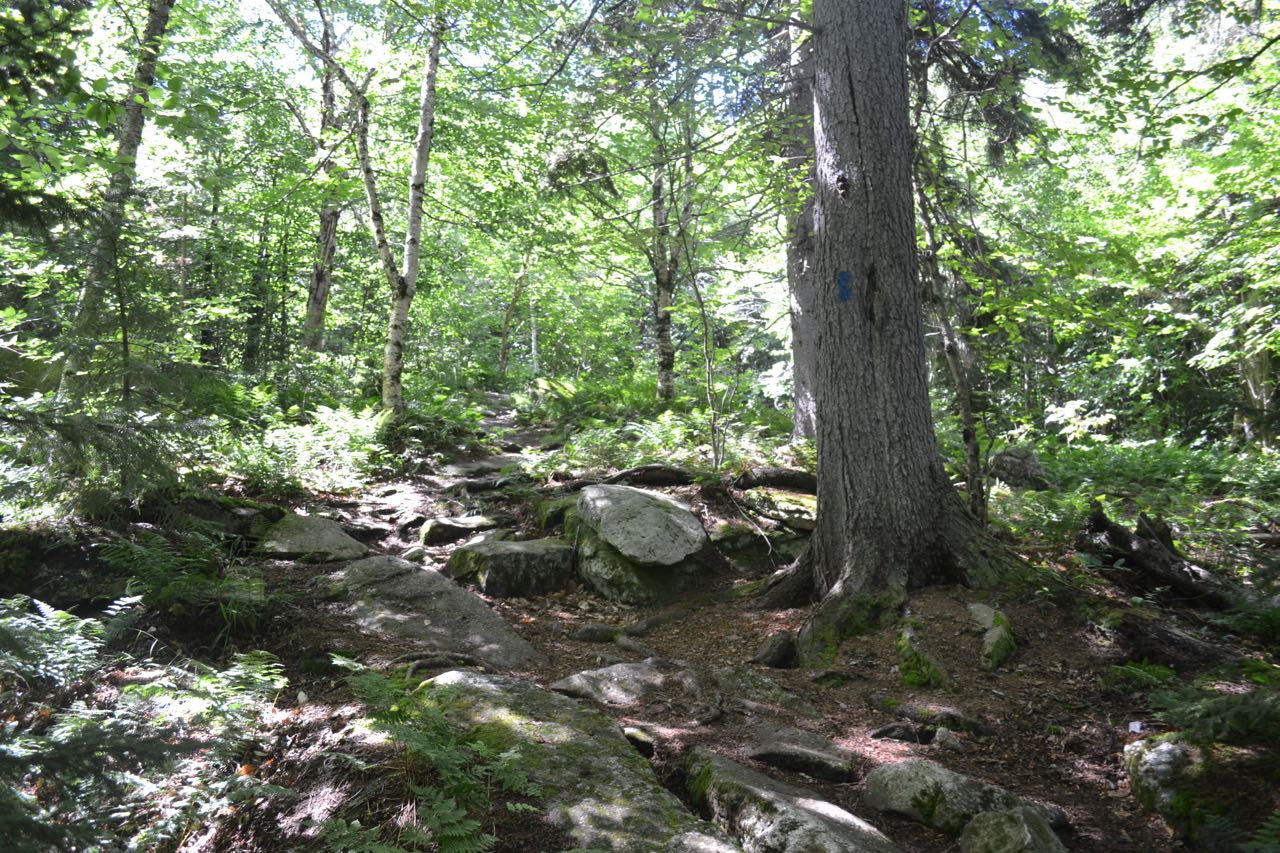
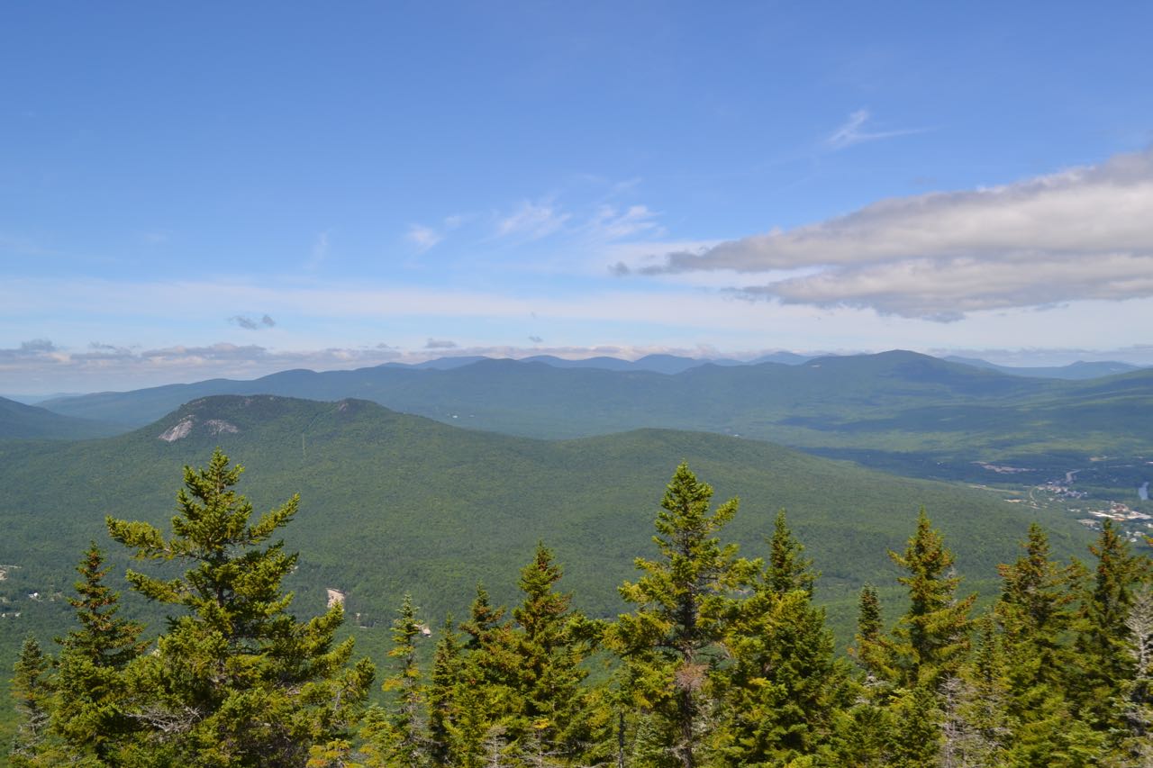
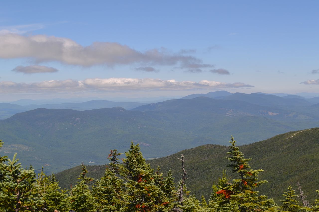
From the trailhead, the Carter-Moriah Trail climbs steeply up a hill, then begins the ascent at a gradual rate. Soon, the trail crosses a small cleared area. After a mile of pleasant walking, the trail becomes slightly rocky. In a bit under another mile, the trail climbs through a rocky clearing filled with birch trees and ferns. Soon after, the trail climbs a small rock slab, quickly heads back into the forest, then emerges on the first of the ledges. There are slight views through the trees to the Northern Presidentials and the town of Gorham. The trail then continues into the forest and passes by the summit of Mt. Surprise at 2.0 total miles. A slight descent follows, then the trail swings left and climbs more steeply, then right and soon comes out onto more ledges. These ledges are quite steep and may be dangerous when wet. Small bushes and mosses line the trail. After a brief section in the forest, it goes back out onto the ledges. From the highest of the ledges, a better view is gained. The Northern Presidentials rise majestically next to the slope of Moriah. One of Mt. Madison's ridges conceals the Great Gulf from view. The ridge line of the Presidentials descends to ledgy Pine Mountain; behind is the Crescent Range, and behind that are the Pliny and Pilot Ranges. Further to the right is Gorham, and above, some of the peaks in Nash Stream Forest are seen, including the distinctive Percy Peaks and giant Long Mountain. This view is mostly blocked on the summit, so these ledges are the best place to enjoy it.
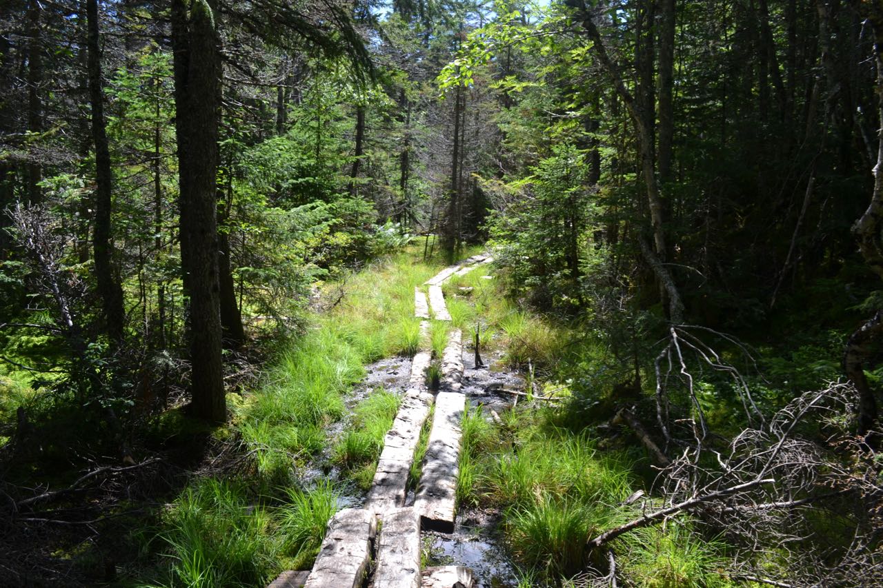
The trail continues its rough ascent through the forest, making a few tricky rock scrambles. After one particularly difficult climb up a rock face, the trail levels out through a forested ledge area, then crosses a bog on bog bridges. It then runs somewhat flat along the side of the ridge crest, passing one large moss-covered rock and a huge above-ground boulder. It soon turns left and climbs to the top of the ridge, then resumes its steep ascent and heads straight up the ridge crest. There are occasional small descents in this section. After a long, straight climb, the trail passes just under the summit; turn right onto a spur and reach the summit of Mt. Moriah at 4.5 total miles.
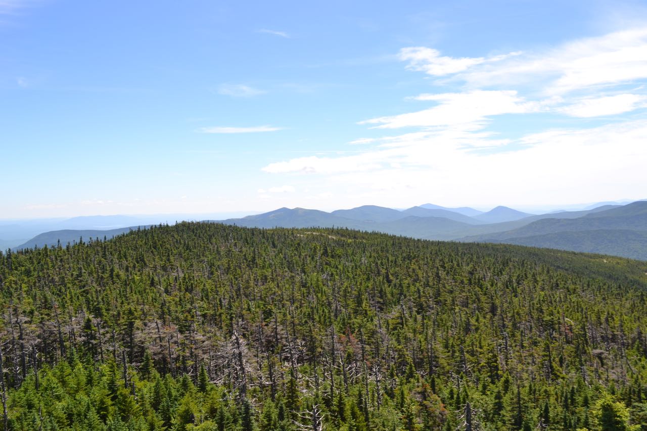
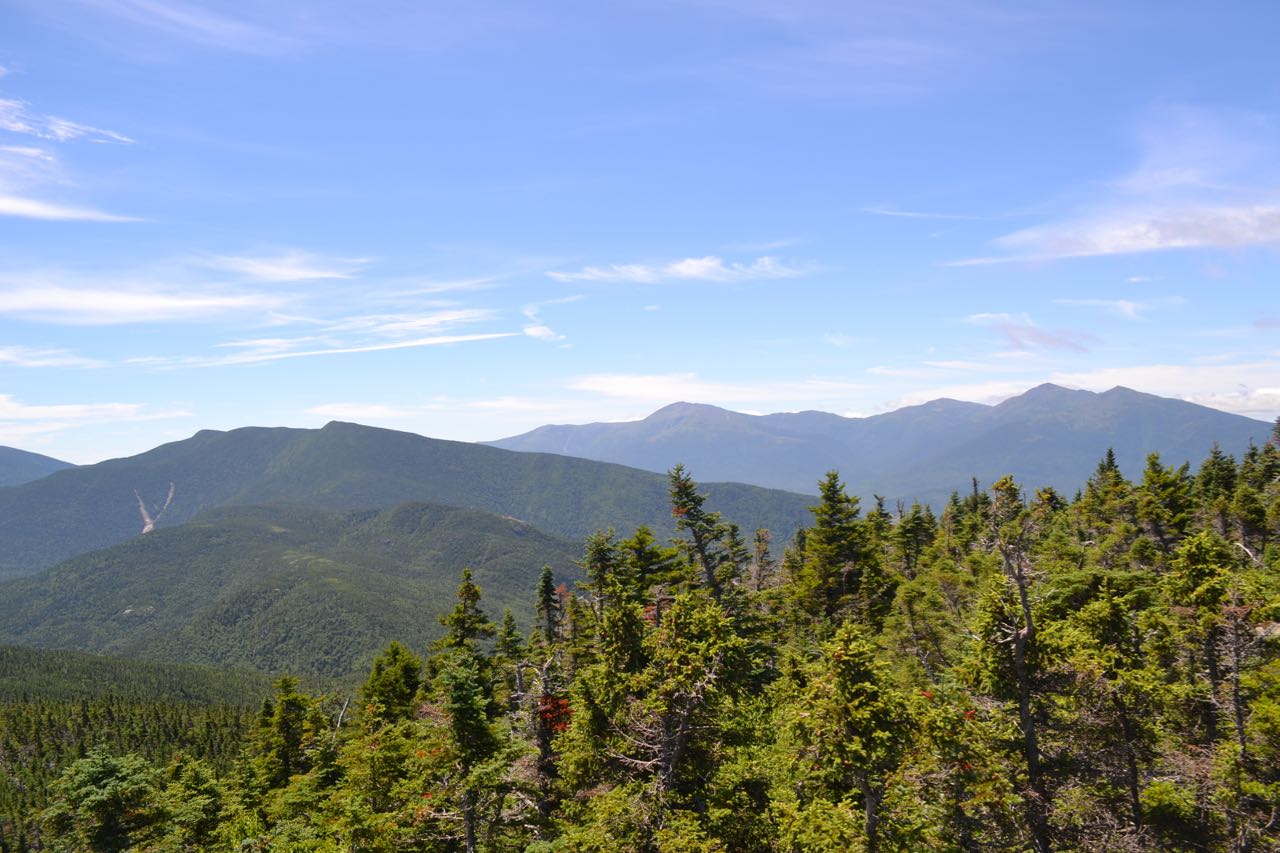
From the dome-shaped summit rock is a fantastic view of the Wild River Wilderness as well as the Northern Presidentials. A small section of trees restricts the view to the northwest. To the north is the rugged Mahoosuc Range; its southwestern end is blocked by the trees. Distant mountains in Maine are seen to both sides of the range. Below the eastern Mahoosucs are the nearby peaks of Middle Moriah and Shelburne Moriah Mountains. To the east is Caribou Mountain in Maine's Caribou-Speckled Mountain Wilderness; Speckled Mountain appears behind Royce Mountain. To the southeast is the Baldface Range; Meader Ridge leads from Mt. Header up to the two conical summits of the Baldfaces. Sable Mountain, Chandler Mountain, and North Doublehead rise in a line to the right, with Kearsarge North behind. The view straight down into the Wild River Valley is blocked by the shoulder of Moriah. On the west side of the Wild River Wilderness rises the rest of the Carter-Moriah Range. Mt. Hight and Carter Dome are seen behind and to the left of Middle and North Carter. To the right of the Carters are the Northern Presidentials, with the Great Gulf now in full view.
Printable directions page